Building toward disaster: Growth collides with rising seas in Charleston
A billion-dollar seawall may shield the city’s wealthy core — but not the vulnerable communities beyond it. Who will be forced to move?


Published by The Guardian
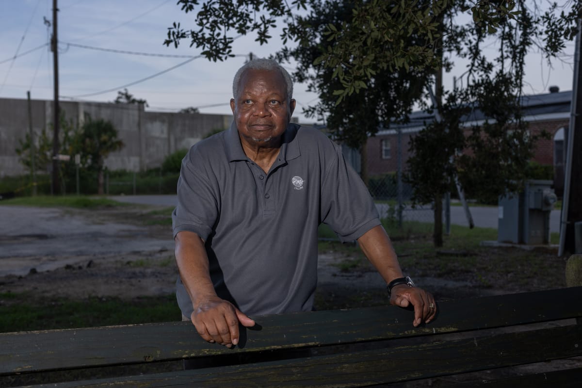
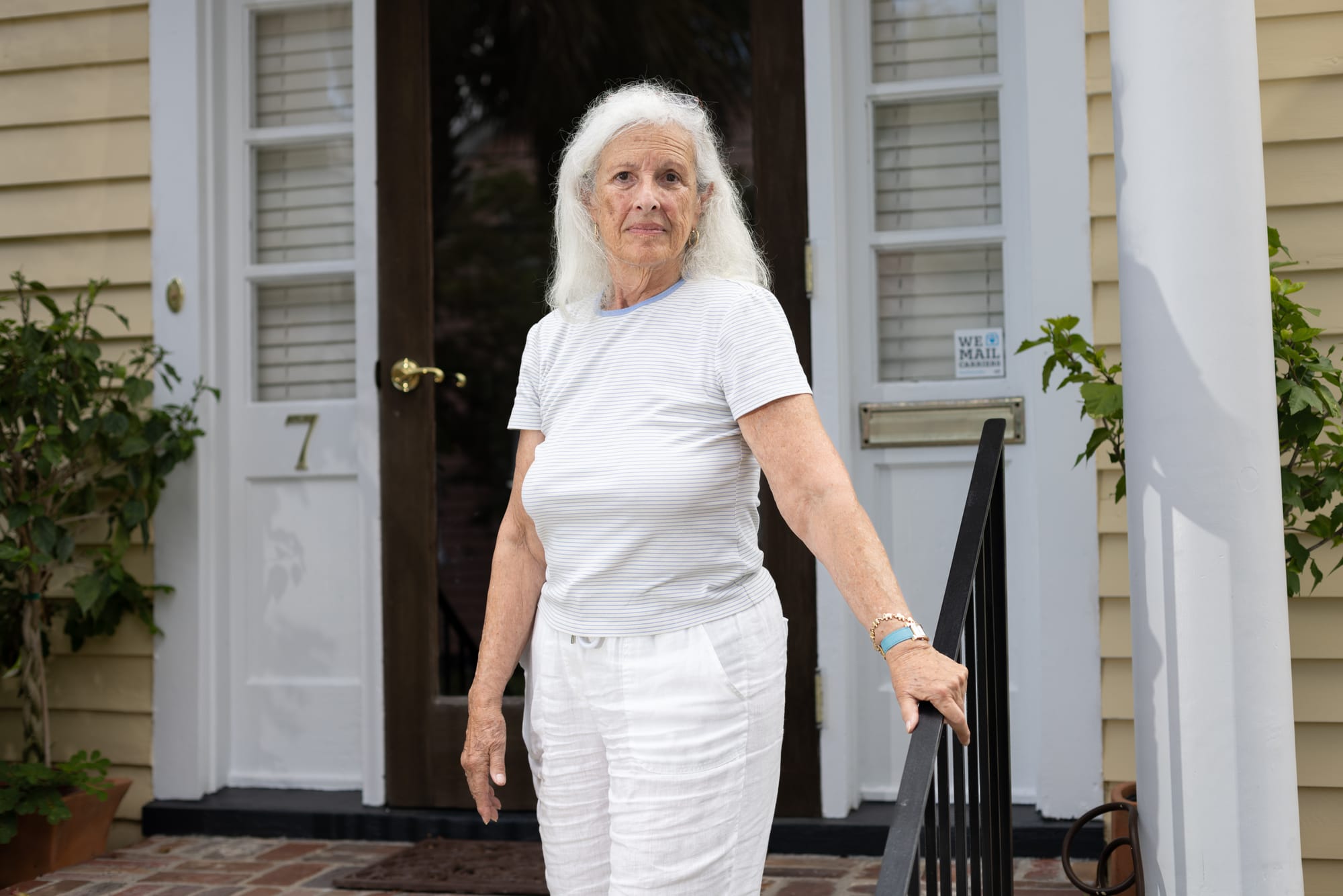
On a quiet street near the marsh in Charleston, South Carolina’s Rosemont neighborhood, Luvenia Brown watches the weather reports more than she used to. She’s lost lawn mowers, bikes and outdoor furniture to the rising waters that have repeatedly crept into her yard.
Brown’s home is elevated, so the water hasn’t reached the interior. Not yet. But she’s deeply worried about what the future will bring.
“If the water continues rising the way it is, I don’t want to be here,” said Brown, 58, who works as a medical driver. “... I love my area. But I think my life is more important.”
Just a half mile to the south, a massive new development — expected to bring stores, offices and 4,000 homes — is springing up. Brown fears that all the new concrete and pavement will only make flooding where she lives worse.
Charleston is one of the fastest-growing cities in the country — and one of the most flood-prone. As climate change prompts sea levels to rise and storms to grow more intense, this historic city has become a warning bell for what’s to come along America’s coasts: Some neighborhoods will retreat and others will be protected, and still others — often lower-income communities — may be left behind.
In Charleston, those futures are colliding. The city and the federal government are planning a $1.3 billion seawall to defend the iconic downtown peninsula with its regal, pre-Civil War mansions and majestic moss-covered live oak trees.
But under the current plans, the wall would not extend to lower-income neighborhoods like Rosemont, a historically Black community bordered by a freeway and hemmed in by industrial sites. That could leave those families more exposed than ever.
“I’ve seen how all those floodwaters demolish people’s houses,” Brown said. “I don’t think I want to be part of that.”
What’s happening in Charleston is playing out in dozens of coastal cities from New York to California. Driven largely by sea level rise, flooding in the coastal United States is projected to occur 10 times more often over the next 25 years, according to a recent analysis by Climate Central, a nonprofit group of scientists and journalists who conduct research on the changing climate. An estimated 2.5 million Americans could be forced to relocate over the next 25 years, the group found.
Nationally, poor communities are disproportionately affected by hurricanes and flooding, research shows.
The increasing floods are prompting insurance companies to raise premiums and decline policy renewals. In fact, ZIP codes in coastal South Carolina are among those with the highest insurance nonrenewal rates, according to a Brookings Institution analysis. All of that is likely to push some residents to higher, or drier, ground.
To understand how Charleston reached this tipping point — and what makes it especially vulnerable — you have to start with its geography.
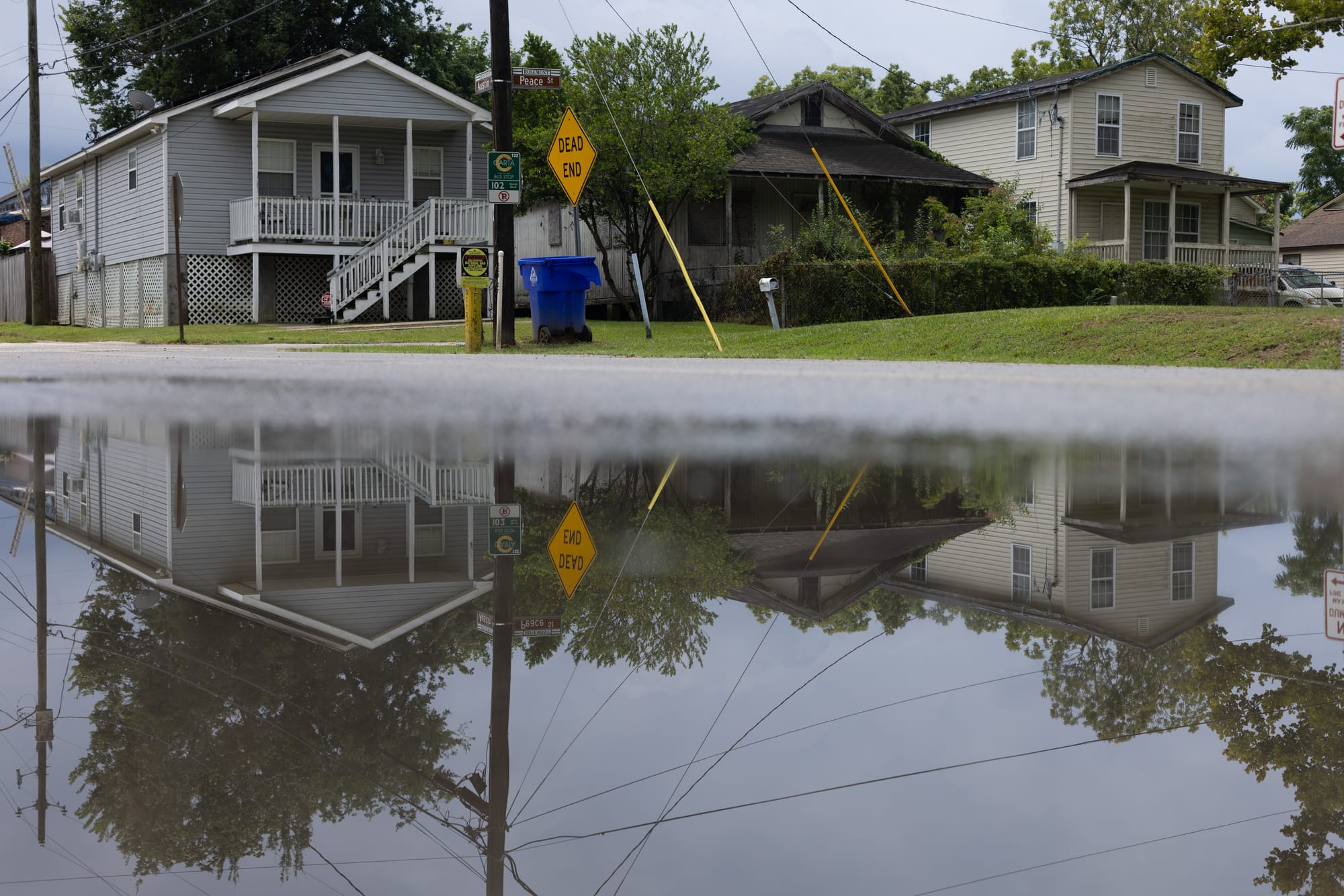
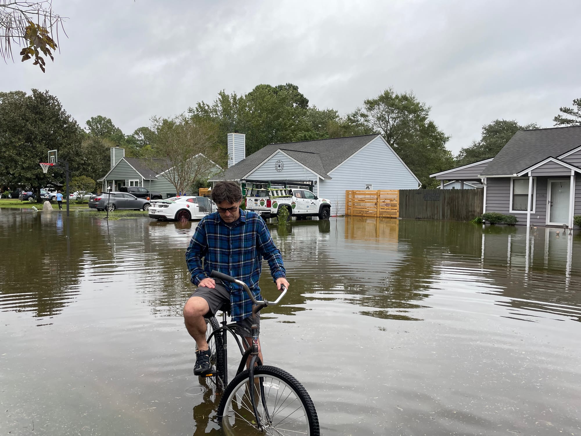
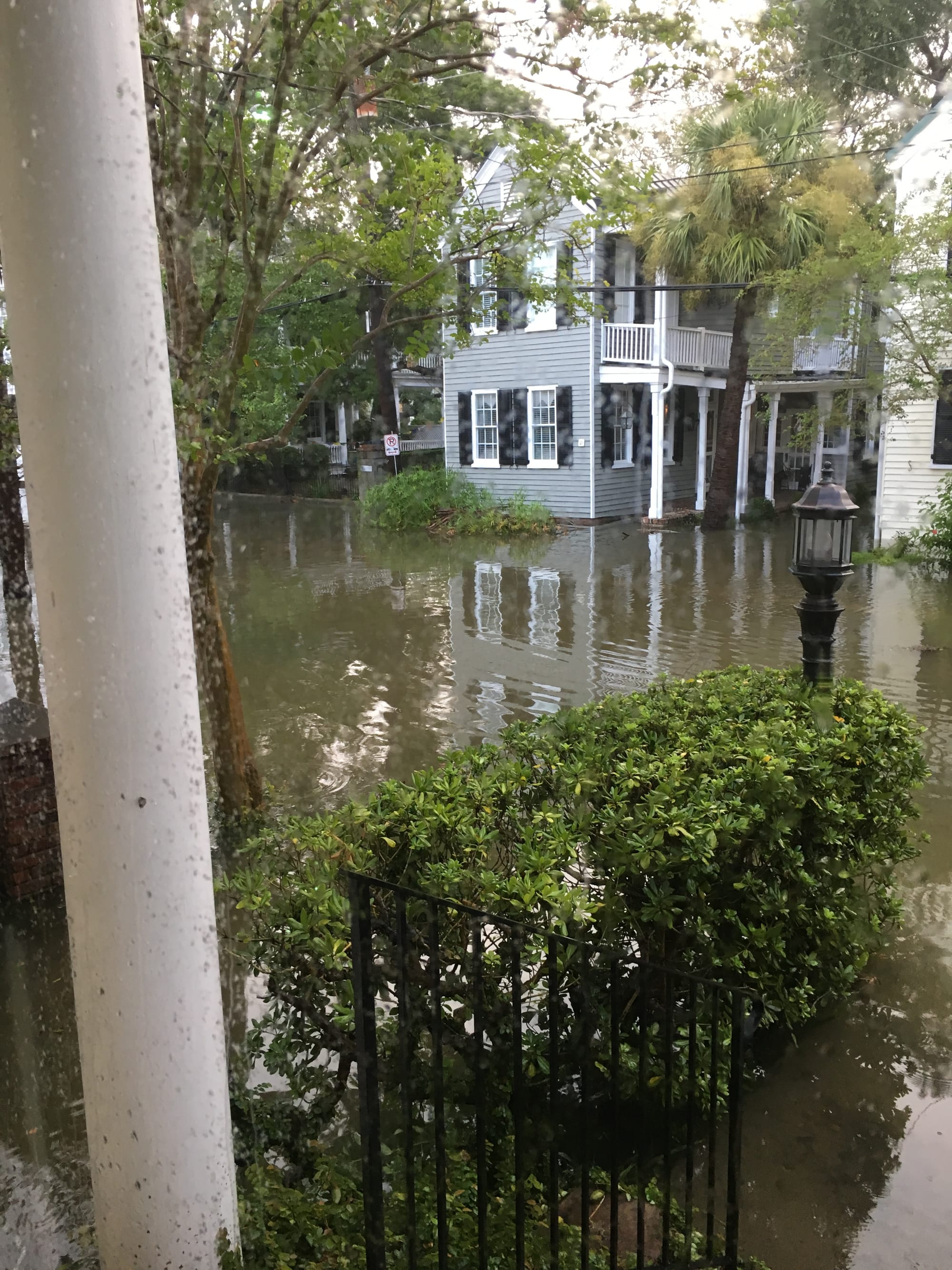
Images left to right: A short afternoon thunderstorm recently left standing water on the streets of Charleston’s Rosemont community. The city and the federal government are planning a $1.3 billion seawall to defend Charleston’s historic downtown. But under the current plans, the wall would not extend to lower-income neighborhoods like Rosemont. Luvenia Brown lives in Rosemont, on a street that floods repeatedly. Based on federal projections for sea level rise, her street will likely be underwater by the end of this century. “If the water continues rising the way it is, I don’t want to be here,” she says. (Jeffrey Basinger / Floodlight)
Rising water, growing crisis
Charleston has always lived with the water.
Built along the confluence of three rivers and the Atlantic Ocean, the city was founded on marshland and mud flats. Flooding there was once far less frequent.
But now, even an afternoon thunderstorm or an unusually high tide can overwhelm drainage systems and submerge streets.
On Aug. 11, a combination of heavy rains and high tide flooded large parts of the city, prompting some motorists to abandon flooded cars. Just 11 days later, another round of flash flooding left parts of Charleston knee-deep in water, forcing dozens of road closures and prompting the city to offer free parking in elevated garages.
And during a recent visit to James Island, just south of the main Charleston peninsula, a Floodlight reporter and photographer observed cars splashing through 2 inches of standing water — the aftermath of a short storm.
The problem isn’t just more rain — it’s higher water. The sea level around Charleston is rising faster than ever. It’s risen about 13 inches over the past century. But by 2050, scientists project it will rise an additional 1.2 feet; and by the end of the century, the water is expected to be about 4 feet higher than it is today.
The ground is sinking, too.
Charleston is one of the most rapidly subsiding cities in the United States, mainly because of groundwater pumping and the settling of natural sediments and filled marsh areas. That double threat — rising seas and sinking land — leaves the city increasingly exposed to flooding.
According to Climate Central’s Coastal Risk Finder, more than 8,000 people and 4,700 homes in Charleston County will be at risk of annual flooding by 2050, even under moderate climate action scenarios. By 2100, more than 60,000 people could be affected.
The Lowcountry, as this region is known, was always low. But now, it's getting lower, wetter and harder to protect.
Rapid development, meanwhile, is paving over forests and wetlands that once soaked up stormwater, which means water runs into residential areas more quickly during torrential rains. Every new subdivision and strip mall replaces absorbent ground with impervious surfaces — asphalt, rooftops, parking lots — that send rainwater rushing into neighborhoods like Rosemont.
The uneven fight against the sea
After Hurricane Matthew sent water surging over Charleston’s iconic Battery wall in 2016, city leaders searched for a new approach. Then-Mayor John Tecklenburg and other officials began consulting with Dutch flood experts, seeking to tap the know-how of a country renowned for its expertise in holding back the sea.
Those conversations helped lay the groundwork for a comprehensive city water plan, which focuses on protecting Charleston from flooding and rising seas while promoting smart, resilient growth. Building on that effort, federal officials introduced a bold proposal: an 8-mile-long seawall, designed by the U.S. Army Corps of Engineers, to shield the city’s historic peninsula from future storm surges and sea level rise.
The total cost of the seawall: $1.3 billion. The city’s share will likely be more than $450 million, and Tecklenburg said that won’t be an easy sell. But to the former mayor, the choice is clear.
“You can't give up the peninsula,” he told Floodlight. “If you give up the peninsula, you might as well head for the hills.”
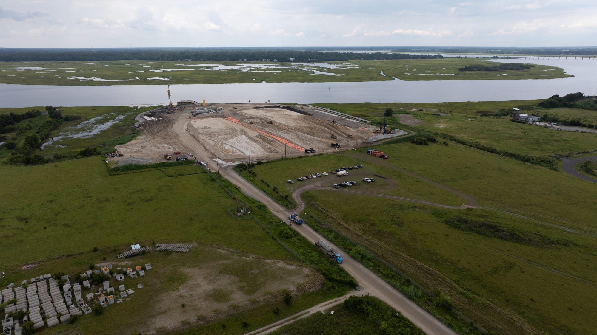
Aerial of downtown Charleston, S.C., which may see a major coastal resiliency project built to protect it from rising seas and a sinking land mass. (Jeffrey Basinger / Floodlight)
But the seawall will protect only the downtown. Neighborhoods like Rosemont — just beyond the wall’s reach — will remain exposed. And some fear the wall could actually make flooding worse in unprotected areas.
Federal sea rise projection maps show that some streets in Rosemont, including Luvenia Brown’s, will likely be underwater by the end of the century. That doesn’t even account for the stronger, more frequent storms scientists say are on the way — the kind that could make flooding here even worse.
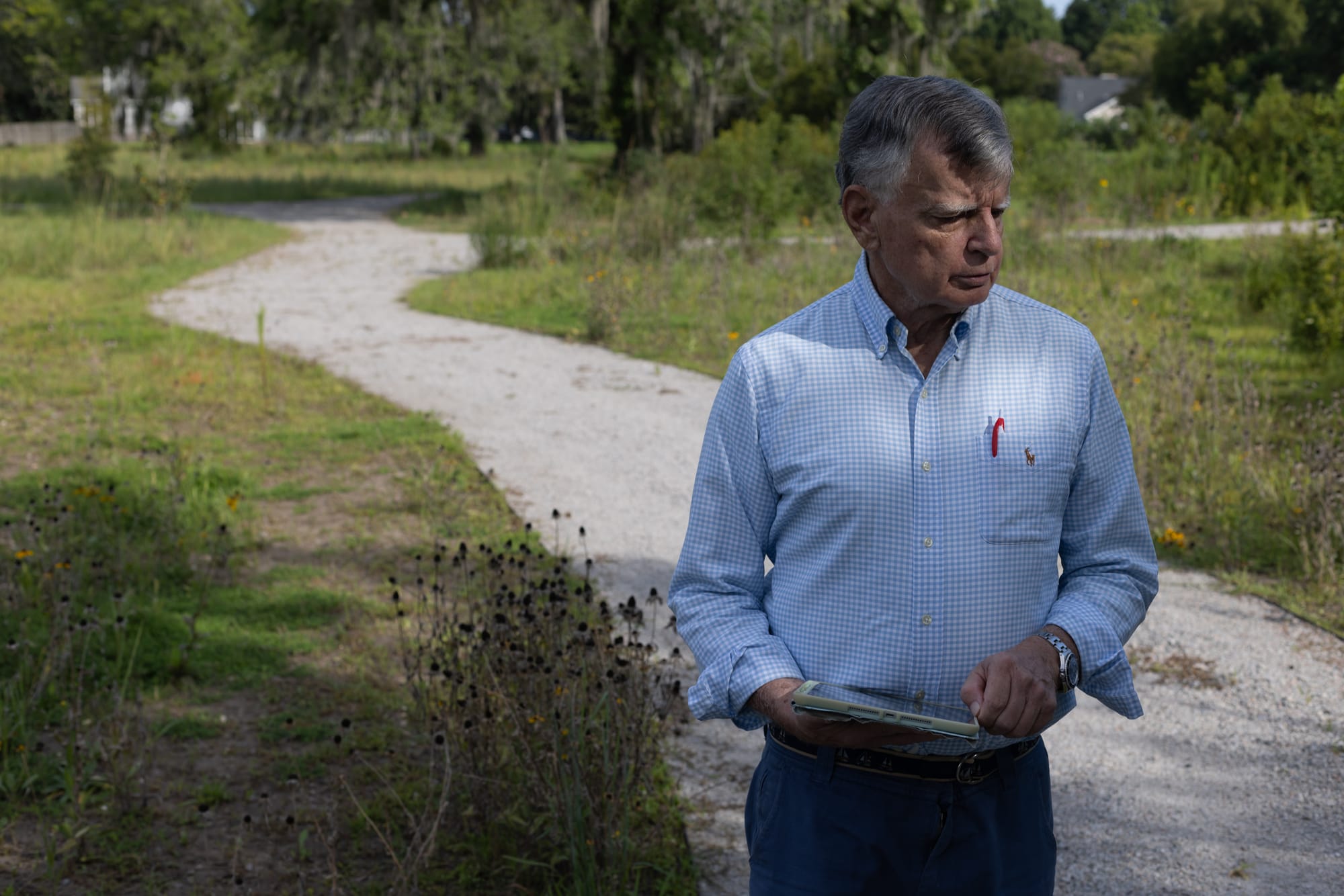
Skip Mikell, a longtime community leader in Union Heights, a historically Black neighborhood just north of Rosemont, has become vocal about the threats that face low-lying communities across the area.
Mikell recently stood at the end of Peace Street in Rosemont, looking out over the neighboring marsh as he discussed what’s ahead: “In 70 years, where we’re standing, if nothing’s done, it’s going to be water.”
In her home one block over, that brings little comfort to Brown. The Ashley River is about a quarter mile from her house, and when storms come, there’s nothing to keep the water away.
But housing prices in Charleston have climbed so high, she’s not sure where she’ll go once it’s time to move.
“The gentry of Charleston have connections, they have money, they have a voice,” Mikell said. “These communities are voiceless.”
The long road to retreat
About 12 miles northwest of downtown Charleston, a tranquil expanse of weeds, marsh grasses and black-eyed Susans stretches across what used to be a neighborhood. Bridge Pointe was once a compact community of 32 townhomes.
Now it’s gone.
The site was returned to nature after the city and federal government bought out its flood-weary residents. But like many buyouts across the country, the process was slow, bureaucratic and agonizing for those caught in limbo.
John Knipper was one of them.
He moved to Charleston in early 2015, newly retired from an IT job in New York. Drawn by the milder winters and lower taxes, he bought a three-bedroom townhome in Bridge Pointe for $172,000. At the time, it seemed like a safe investment. It was a tidy, attractive community, with garages, wood-burning fireplaces — and no history of flooding, even during Hurricane Hugo in 1989, he said. His flood insurance premium was minimal.
But just six months after he moved in, an August thunderstorm turned a nearby creek into a river. Several inches of water crept into his living room. Then came October 2015. A stalled weather system dumped more than 15 inches of rain on the region. His first floor was submerged under 2 ½ feet of water.
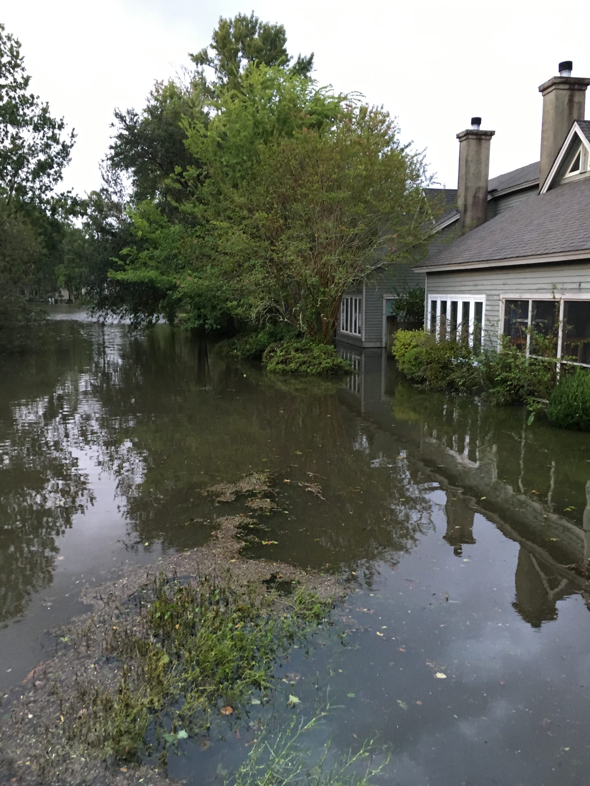
Images left to right: A 2016 flood turned much of Charleston’s Bridge Pointe community into a lake. After four floods in three years repeatedly damaged the Bridge Pointe townhomes, the city of Charleston and the federal government bought out the community’s 32 homes. (Photo courtesy of John Knipper) / Darin Jones bikes on Shoreham Road after Hurricane Ian flooded the street in 2022. Jones and his wife, Ana Zimmerman, once lived on the street but moved after their home repeatedly flooded. Zimmerman predicts that entire neighborhoods will have to move as the sea level rises and storms grow more intense. (Photo courtesy of Ana Zimmerman) / Ann Auburn and her husband moved from their historic Charleston home because they were fed up with the floods that repeatedly damaged and threatened the house. This photo, taken from across Gadsden Street, shows the floodwaters surrounding Auburn’s house in September 2017. (Photo courtesy of Ann Auburn.)
Over the next few years, the floods kept coming. The neighborhood sits in the Church Creek basin, a low-lying, heavily developed part of the West Ashley section of Charleston, west of the city’s main peninsula.
About a year after the second flood, the city applied for a FEMA buyout to help Bridge Pointe’s residents relocate. But the application was rejected.
In 2016, Hurricane Matthew struck. The next year brought Tropical Storm Irma. Knipper and his neighbors waited uneasily for the next storm. He kept a stack of bricks by his front door to quickly elevate heavy furniture when the floodwaters came.
In 2017, FEMA authorized $10 million to buy out the Bridge Pointe homes and a handful of others nearby. By then, Bridge Pointe had flooded four times.
“Those homes were really unsellable,” Knipper recalled. “So then you finally find out that you’re going to get bought out — it’s like, hallelujah.”
But then he and his neighbors had to wait some more. Appraisals. Negotiations. It wasn’t until mid-2019 — nearly four years after buyout discussions began — that the last residents received checks to relocate.
“It was a classic story of government red tape,” said former Mayor Tecklenburg. “... It was just too hard and too long.”
Such delays aren’t unique to Charleston. A review by the Natural Resources Defense Council found that the median time to complete a flood buyout nationwide is more than five years.
A 2020 report by the U.S. Government Accountability Office, meanwhile, found there's no national strategy or steady funding for relocating people from flood-prone areas.
Knipper eventually settled in Summerville, 15 miles inland. His new home is at the end of a cul-de-sac on slightly higher ground than most of his neighbors. It has stayed dry so far. But even there, nearby streets sometimes flood during heavy storms.
“There’s flooding risk everywhere,” he said.
Back at the Bridge Pointe site, nature has returned. A pond formed where buildings once stood. On a recent morning there, ducks glided across the surface while an egret perched on a stump.
Looking out over the pond during a recent visit to his old neighborhood, Knipper said:
“I guess what it says to me is the land shouldn’t have been built on in the first place.”
As wetlands disappear, risks grow
Just a mile away, many more homes are on the way.
Long Savannah is expected to bring up to 4,500 homes. It’s one of several massive projects rising across Charleston County.
Environmental groups note that Long Savannah will destroy wetlands, which work like nature’s sponges, soaking up rain and slowly releasing it to keep flooding in check. As more land is paved, rainwater that once filtered slowly into the ground now surges across hard surfaces, overwhelming storm drains and flooding streets and homes.
Initially, state environmental officials approved plans to fill 137 acres of wetlands and excavate 72 more.
“This type of ‘fill and build’ activity is exactly what has led to repeated flooding in adjacent neighborhoods,” the South Carolina Environmental Law Project (SCELP) warned in a 2020 news release.
Following a legal challenge by SCELP, the Southern Environmental Law Center (SELC) and other groups, the developers agreed to reduce the wetlands impact — though roughly 160 acres are still expected to be destroyed.
Other massive developments on the books include Magnolia Landing, the 4,000-home project underway near the Rosemont community, and Cainhoy, a 9,000-home development planned for a peninsula near Charleston.
Environmental groups sued to prevent Cainhoy’s developers from filling wetlands.
But in 2022, a federal judge dismissed their flooding concerns, citing a U.S. Army Corps of Engineers report, which concluded Cainhoy has a “high percentage of wetlands and ... numerous direct outfalls to tidal waters that will minimize the potential for heavy rains to overwhelm its infrastructure.”
As a former county floodplain management coordinator, Anna Kimelblatt understands the risks of allowing mega developments in flood-prone areas.
“People will be inundated,” said Kimelblatt, who now works for the Coastal Conservation League, a nonprofit that works to protect the environment in South Carolina. "Their roads will be inundated, their yards will be inundated, their homes will be inundated. And it creates this vicious cycle here in Charleston, where we fill, we build, we flood, we buy out.”
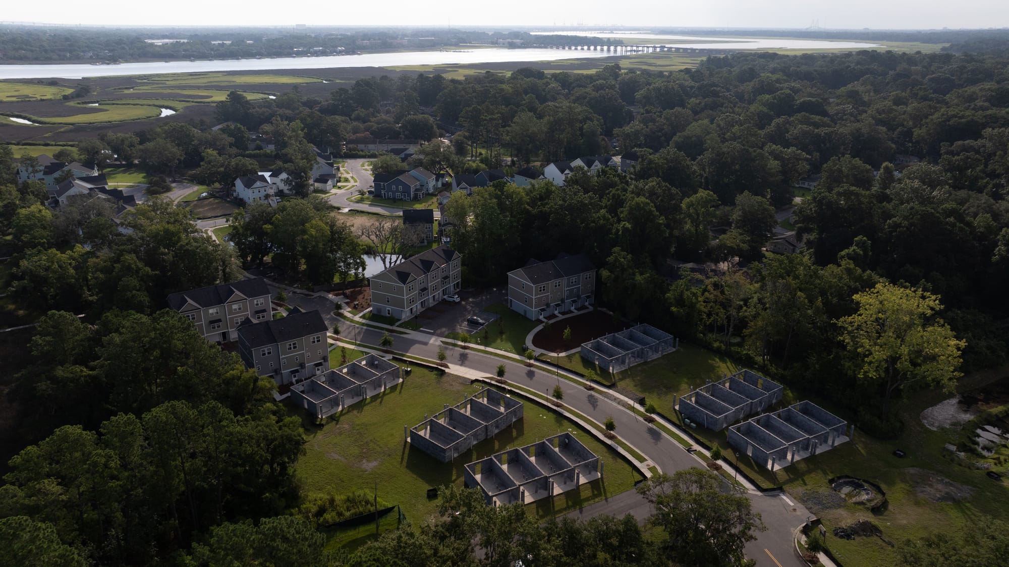
Images left to right: A new townhome development rises in Charleston’s flood-prone Church Creek area. The Ashley River and Church Creek can be seen in the background. A recent aerial view of the site along the Ashley River, in Charleston, where land is being cleared for the 4,000-home Magnolia Landing development. Critics say massive new developments like these are likely to exacerbate flooding in surrounding areas. (Jeffrey Basinger / Floodlight)
That pattern, some warn, is unsustainable.
“Charleston has a history of building in repetitively flooded areas,” said Robby Maynor, a climate campaign associate with the SELC. “We absolutely must stop building in low-lying and flood-prone areas to avoid making an already difficult situation even worse.”
Some residents share those objections. “The thing I don’t understand is, why don’t they put a moratorium on coastal building?” Knipper asked. “They know they’ve got a problem. They know it floods. They know it’s only getting worse. … Yet the building continues.”
Despite environmental concerns, new construction continues at a brisk pace — though it now comes with updated building requirements.
Charleston city officials say they now require flood protections — such as higher elevation standards and better stormwater systems — for new buildings in flood-prone areas. But scientists and residents question whether those measures are enough, or whether building in risky areas simply shifts the danger to others.
“A similar story is playing out in cities all across the United States,” reports NASA’s Earth Observatory, “but the Charleston area stands out in one critical way — much of the new development has happened on low-lying land that is especially vulnerable to sea level rise and flooding.”
‘Canary in a coal mine’
Ana Zimmerman calls her old street on James Island the “canary in a coal mine” — an indication of what will happen across the coastal United States where homes were built in flood-prone areas and at low elevations.
Zimmerman and her husband bought their modest, one-story house on Shoreham Road — a short, peaceful street lined with similar homes — in 2005.
It was a close-knit neighborhood where neighbors looked after each other’s kids, and where the Zimmermans’ backyard — with its homemade playground and Fenway-green treehouse — became a favorite hangout for the children on the block.
The first sign of trouble came early one morning in October 2015. It was still dark when she awoke that day, and when she put her feet to the bedroom floor, water lapped at her ankles. A powerful storm had overwhelmed the street. Zimmerman rushed to save photo albums and the family cats, but the house suffered more than $80,000 in damages.
With the insurance payout and their own labor, the Zimmermans repaired the home.
But when Tropical Storm Irma hit two years later, the damage was worse. So was the emotional toll. Zimmerman remembers hearing neighbors screaming as floodwaters poured into their homes.

Her house took on 7 inches of water — and this time an insurance adjuster declared the house a total loss.
She and her husband soon made a decision: They were not willing to go through it again.
FEMA offered $30,000 if they would demolish the house. But there was a catch. The bank that held the mortgage would not allow that unless the Zimmermans paid off the mortgage — something they couldn’t afford to do.
The Zimmermans loved their neighbors. But they felt they’d been left with few options. Ultimately they abandoned the flood-damaged home and let it go into foreclosure, walking away from 12 years of equity.
“We didn't even get to choose how we were going to lose,” Zimmerman said.
The family moved to a nearby home on James Island and brought a neighbor to live with them — an 88-year-old man who had lived alone across the street. Their new house is built on an elevated foundation, not on a ground-level concrete slab like their old house. So far, there’s been no flooding.
Zimmerman, who calls herself an “unintentional flood activist,” has pressed public officials for stricter building rules and clearer flood-risk disclosures.
Most of Zimmerman’s former neighbors on Shoreham Road have left the neighborhood, she says. During a recent visit back to the street, Zimmerman pointed to house after house: “This house has flooded. That house has flooded … This house has massively flooded. …”
New residents have moved into the homes vacated by the Zimmermans and their former neighbors. And they, too, have experienced flooding on their street.
So what’s ahead for Charleston and other coastal cities as the rate of sea level rise accelerates?
“Entire streets will have to move,” said Zimmerman, a college biology professor. “Entire neighborhoods will have to move.”
Those who have the money and ability to move will be OK, she said.
“But the vulnerable among us, there will be no one there to help them, save them, and they will not be able to save themselves,” she said.
‘We can’t live with this’
Susan Lyons lives on Gadsden Street, just two blocks from the Ashley River. Since moving there in 2004, she’s seen more than a dozen serious floods. She’s repeatedly been forced to replace the ductwork under her 122-year-old home — repairs that have cost thousands.
But what weighs on her even more is the anxiety. When bad storms threaten, Lyons sometimes checks into a hotel to find safety and peace of mind.
“Whenever these storms or high tides come around, my blood pressure goes up and my knuckles get white,” the 82-year-old former newspaper reporter says. “It scares me.”
Over the past decade, Lyons has watched her neighborhood change. Neighbors pour money into elevating homes. About half of the houses on her block have changed hands — some more than once — as families overwhelmed by flood risks sell and leave.
Just half a mile away, Roper St. Francis Hospital is preparing to relocate, a stark sign of how flooding is reshaping the city’s landscape.
“The F word (flooding) is being replaced by the R word: retreat,” said Lyons, who helped form a group called Groundswell to push for stronger city action on flooding issues.
Ann Auburn and her husband once lived across the street from Lyons.
Drawn to the neighborhood’s historic charm and welcoming community, they bought their 120-year-old house in 1999 and split their time between Charleston and Connecticut.
But with each flood came more worry. She recalls friends wading through 6 inches of water to visit, and the time and money spent to replace ruined ductwork.
Then came Hurricane Irma in 2017. Auburn sat on the stairs as water crept under the front door and seeped up between the floorboards.
The following year, the forecast for Hurricane Florence forced the couple to postpone a long-planned vacation.
“At that point, we said, ‘We can't live with this. It’s just not who we want to be,’ ” she said. “ … I did not want to live through hurricane seasons, year after year after year, worrying about the house.”
Auburn and her husband left Charleston, moving back to Connecticut full time. Later, they returned — not to their old neighborhood, but to rent a house on higher ground.
Their lease ends this spring, and the future is uncertain. But one thing is clear: They won’t be buying another house in Charleston.
“I think the whole concept of climate migrants is real,” Auburn said. “And Charleston, as beautiful as it is, as lovely as it is, as many people want to come there, I would suggest you come now. Because I don’t know what it's going to be like in 20 years.”
Floodlight is a nonprofit newsroom that investigates the powers stalling climate action.
Ames Alexander is an investigative reporter at Floodlight. For more than three decades, his reporting has spurred reforms and saved lives, and he was a lead reporter on two investigations named finalists for the Pulitzer Prize.